Monitoring the Oceans from Space (FutureLearn)

Offered by EUMETSAT,
Monitoring the Oceans from Space (FutureLearn)

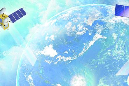
Explore our oceans from space. Discover how Earth observation allows us to monitor ocean health, and inform policy and planning. This free online course will provide an introduction to ocean monitoring Earth Observation (EO) satellite data, and its uses, types and challenges. It will explain how the data is acquired and used, the range of data types available, and the terminology and techniques involved.

Class Deals by MOOC List - Click here and see FutureLearn's Active Discounts, Deals, and Promo Codes.

The course is presented by physicist, oceanographer and broadcaster Dr Helen Czerski from University College London, remote sensing specialist Dr Hayley Evers-King from the Plymouth Marine Laboratory, and the lead educator Dr Mark Higgins from EUMETSAT.
The course is run by EUMETSAT in support of the Copernicus Programme.

Explore ocean monitoring EO data using real-world examples
You will look at practical examples of using ocean monitoring EO data - in real-world case-studies and in a range of areas of policy and decision-making - and will explore emerging technologies and trends.
The course will introduce you to the operational marine data stream from EUMETSAT in the context of the ‘Copernicus’ programme. It will highlight the role of the Sentinel-3, Sentinel-6 and Jason-3 ocean monitoring satellites and the contributing missions providing marine data for Copernicus – such as Metop and Meteosat. You will also explore the role of the Copernicus Marine Environment Service (CMEMS), focussing on the applications of its data for users and its wider benefits to society.

Examine different areas of ocean monitoring week by week
The course consists of five themed weeks:

Week 1 - Oceans and Climate
How do the oceans play a key role in the Earth’s climate system? How are the oceans set to be affected by changes in climate and why is satellite data so valuable for addressing multiple challenges in the marine environment?

Weeks 2 & 3 - Oceans, Weather and Hazards
What role do our oceans play in weather forecasting? How does monitoring our oceans from space play a key role in this and how is satellite data used in weather models? How can we use satellite data to understand ocean hazards?

Week 4 - Living Oceans
How do satellites help to monitor, quantify and preserve ocean biodiversity?

Week 5 - Oceans and Us
How does Earth observation help us to set international policy, manage ocean resources and biodiversity? How can the oceans be used for renewable energy? How can the public get involved in ocean science?

Learn with ocean monitoring experts from EUMETSAT and major research centres
Throughout the course, you will learn with experts from EUMETSAT - one of the key global organisations involved in ocean monitoring using satellite data - and from its research partners including Plymouth Marine Laboratory, National Oceanography Centre, CLS, Mercator Ocean, and the NASA Jet Propulsion Laboratory.
(Animations, data visualisations and imagery from ESA, NASA and CMEMS are provided courtesy of ESA, NASA and CMEMS. This course is produced for EUMETSAT by Imperative Space).

Requirements
This course is designed for people who want to learn and explore more about Earth observation and ocean monitoring from space. It is ideal for new potential EO marine data users as well as existing professionals working in other areas of EO, oceanography or environmental science.
It will also help policy-makers, decision-makers, communicators, educators and the general public gain a better insight into the use of satellite data in environmental and ocean monitoring.
Go to Class
MOOC List is learner-supported. When you buy through links on our site, we may earn an affiliate commission.

Related Courses

Come Rain or Shine: Understanding the Weather (FutureLearn) FutureLearn
University of Reading

Come Rain or Shine: Understanding the Weather (FutureLearn)

Understand and explore the physical processes behind the weather. Weather affects our lives almost every day through what we wear, what we eat and what we do. But why is it rainy, windy or sometimes even sunny? Explore some of the physical processes driving UK weather systems and get hands on in the world of weather with practical activities and fieldwork.

Self Paced
3 Weeks
Global Energy and Climate Policy (Coursera) Coursera
University of London,SOAS University of London

Global Energy and Climate Policy (Coursera)

The Global Energy and Climate Policy course offers an introduction to the theoretical and practical understanding of how energy and climate change policies are designed, shaped, advocated and implemented. As energy markets go truly global, domestic energy policies are becoming more and more entangled with wider issues of international governance. Concurrently, the urgent need to mitigate and adapt to climate change and transition to a low-carbon future is adding a further layer of complexity.

Jul 27th 2026
5-12 Weeks
Backyard Meteorology: The Science of Weather (edX) EdX
HarvardX,Harvard University

Backyard Meteorology: The Science of Weather (edX)

Learn to forecast the weather just by looking out your window. The weather forecasts we see every day are based on an army of meteorological sensing networks and intensive computer modeling. Before the rise of these technologies, predictions were made by methods like discerning cloud formations and wind directions.

Self Paced
Self-Paced
Climate Solutions (edX) EdX
University of Edinburgh,EdinburghX

Climate Solutions (edX)

We are in a Climate Emergency. The actions we all choose to take over the next decade will decide whether we succeed or fail to meet the biggest challenge to our civilisation in the 21st century. Learn how you can help tackle climate change. The Climate Solutions course is designed and delivered by award-winning climate change experts and educators.

Self Paced
Self-Paced
Shipwrecks and Submerged Worlds: Maritime Archaeology (FutureLearn) FutureLearn
University of Southampton

Shipwrecks and Submerged Worlds: Maritime Archaeology (FutureLearn)

Learn how maritime archaeology investigates our changing relationship with the world’s oceans and seas, from 2.5 million years ago until today. People have explored and depended on the oceans of our planet for millennia. During that time the geography of our world has changed radically as coastal regions have flooded and islands have risen up, or been lost beneath the waves. With 70% of the world’s surface covered by water, an unparalleled, yet largely untouched record of human life has been left beneath the sea for us to discover, from our earliest ancestors right through to present day.

No sessions available
4 Weeks
Monitoring Climate from Space (FutureLearn) FutureLearn
European Space Agency

Monitoring Climate from Space (FutureLearn)

Explore our planet from space and learn how Earth observation is used to monitor climate change, with this free online course. It is increasingly essential for us to study climate change across the planet at the highest level of detail possible. But how can we achieve such a comprehensive worldwide view?

No sessions available
5-12 Weeks
Earth Observation from Space: the Optical View (FutureLearn) FutureLearn
European Space Agency

Earth Observation from Space: the Optical View (FutureLearn)

Discover how optical Earth observation data is gathered and used in this free online course from the European Space Agency (ESA). Earth observation (EO) encompasses a series of techniques that use remote sensing to monitor changes to our climate, and natural and built environment.

No sessions available
5-12 Weeks
The Frozen Frontier: Monitoring the Greenland Ice Sheet from Space (FutureLearn) FutureLearn
European Space Agency

The Frozen Frontier: Monitoring the Greenland Ice Sheet from Space (FutureLearn)

Learn how the Greenland ice sheet is monitored from space and the ground, to understand our past, present and future climate. Made up of layers of compressed snow from over the last 100,000 years, the vast Greenland ice sheet acts as both a valuable record of our past climate and a bellwether for future climate change. This online course highlights how the Greenland ice sheet is monitored from space and the ground. You’ll look at the measurements made possible by Earth Observation (EO) satellites like Cryosat, the technologies and techniques involved, the data generated, and its uses and challenges.

No sessions available
3 Weeks