EdX

Introduction to Urban Geo-Informatics (edX)

Introduction to Urban Geo-Informatics (edX)

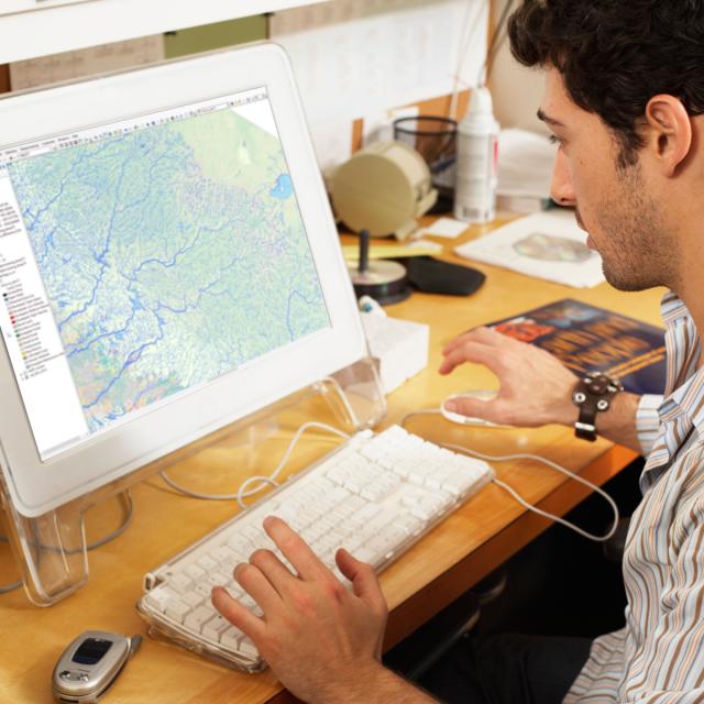
Learning about geospatial technologies, such as GIS, Remote Sensing, GNSS and Underground Mapping, to solve urban environmental issues. In this course, you will explore various technologies involved in Geo-Informatics, how the technologies help us to retrieve spatial data, and more importantly how the geographical data becomes the information used in decision making.

Class Deals by MOOC List - Click here and see EdX's Active Discounts, Deals, and Promo Codes.

“Where does geographical data come from?”
“How do we monitor our environment?”
“How do we navigate with our phones?”
“What is happening beneath our feet?”
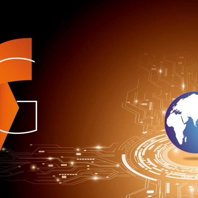
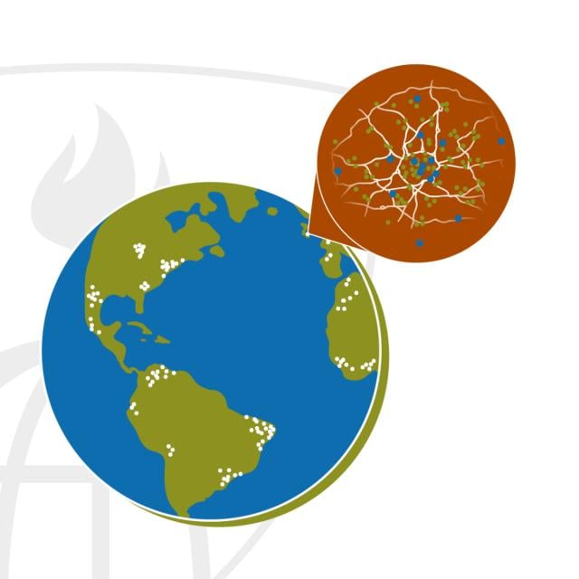
These are just some of the questions that crop up every so often as we wander around the streets of our urban metropolises. Many of the technologies we used, many of the decisions we made are based on spatial data, most of which are acquired from Geospatial Technologies. This data and the interpretation of the data is known as “Geo-Informatics”.

You will explore the fields of Remote Sensing, Geographic Information Systems (GIS), Global Navigation Satellite Systems (GNSS) such as GPS, and Underground Mapping. Additionally, the concept of Smart City and the Urban Environment will be introduced to you. From this, you will gain an understanding of how these technologies help us to shape and understand the world that we are living in.

What you'll learn

  • Issues surrounding the Urban Environment
  • History and skills involved in the different Geospatial Technologies (Remote Sensing, GIS, GNSS, Underground Mapping)
  • Discover how Geospatial data is collected, analyzed and used to shape our world

Syllabus

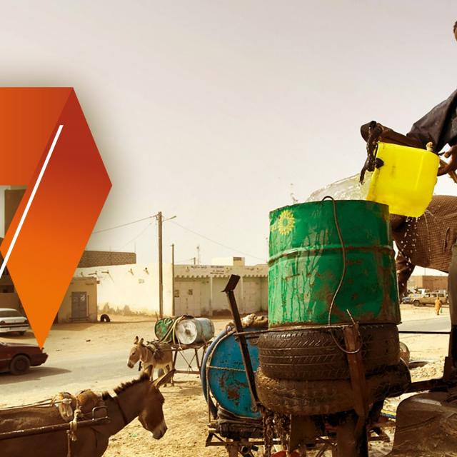
Week 1: The Urban Environment
Introduction to the urban environment and its issues.
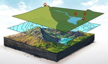
Week 2: GIS
Introduction to Geographic Information Systems (GIS); its role and how data are analysed inside a GIS, the applications of GIS and how it is integrated into our lives.

Week 3: Remote Sensing
Introduction to Remote Sensing; its history and techniques, how data are acquired through Remote Sensing technologies and how they are processed.

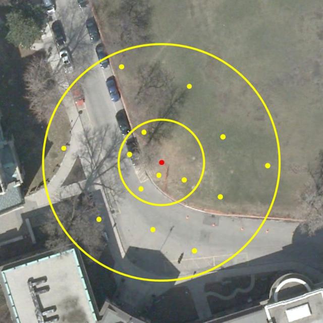
Week 4: Underground Survey & Mapping
Introduction to methods for Underground Mapping, how to see the unseen.

Week 5: Navigational Systems
Introduction to how we position ourselves on Earth, how we navigate through our surroundings, and the different Systems.

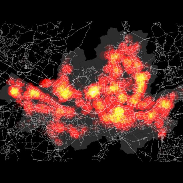
Week 6: Smart Cities
Introduction to what is a Smart City, where Big Data come from, and how we can use Big Data to shape our world.

Go to Class
MOOC List is learner-supported. When you buy through links on our site, we may earn an affiliate commission.

Related Courses

Smart Cities - Management of Smart Urban Infrastructures (Coursera) Coursera
École Polytechnique Fédérale de Lausanne

Smart Cities - Management of Smart Urban Infrastructures (Coursera)

Learn about Smart Cities within the context of management of urban infrastructures. The introduction of Smart urban technologies into legacy infrastructures has resulted in numerous challenges and opportunities for contemporary cities and will continue to do so. This course will help you to understand how to make the best of these smart technologies in your cities’ legacy infrastructures.

Jun 5th 2026
5-12 Weeks
Management of Urban Infrastructures – part 1 (Coursera) Coursera
École Polytechnique Fédérale de Lausanne

Management of Urban Infrastructures – part 1 (Coursera)

Sustainability, Resilience and Efficiency are fundamental considerations for city managers in managing urban infrastructures. Today, more than 3.9 billion people, making up more than 54% of the global population, live in cities. Urbanization is expected to continue in the coming years, raising the urban population to 6.0 billion by 2045. This dramatic increase in urban populations will inevitably increase the demand for energy, mobility (transportation), water, and other urban services in every city around the world. Without functional governance and management structures that ensure efficient, resilient and sustainable performance in cities, the current urbanization growth might become a catastrophic risk threatening the quality of life of the humanity.

May 25th 2026
5-12 Weeks
Nature Based Metropolitan Solutions (edX) EdX
Wageningen University,Delft University of Technology,DelftX,WageningenX

Nature Based Metropolitan Solutions (edX)

Discover the potential benefits of nature-based solutions (NBS) in metropolitan areas and develop strategies for their implementation. How can ecosystems contribute to quality of life and a more livable, healthier and more resilient urban environment? This course establishes the priorities and highlights the direct values of including principles based on natural processes in urban planning and design.

Oct 27th 2021
5-12 Weeks
Sustainable Urban Environments (edX) EdX
Trinity College, Hartford,TrinityX

Sustainable Urban Environments (edX)

Learn how integrated systems and individual actions can shape sustainable cities, generating higher quality of life for the future. How can we strengthen sustainability? By empowering individuals and communities to transform and balance dynamic natural resources, economic prosperity, and healthy populations. In this course, you’ll explore productive and disruptive social, ecological, and economic intersections – the “triple bottom line.”

No sessions available
5-12 Weeks
Digitalisation in Space Research (Coursera) Coursera
Technische Universität München - TUM

Digitalisation in Space Research (Coursera)

This course provides an overview of the most important digital applications in the field of aerospace research. The course instructors discuss how digitalisation is impacting and changing both satellite-based and manned spaceflight research. One unit is specifically devoted to exploring the use of artificial intelligence in the evaluation of satellite data.

Jun 1st 2026
3 Weeks
Getting Started with CyberGIS (Coursera) Coursera
University of Illinois at Urbana-Champaign

Getting Started with CyberGIS (Coursera)

This course is intended to introduce students to CyberGIS—Geospatial Information Science and Systems (GIS)—based on advanced cyberinfrastructure as well as the state of the art in high-performance computing, big data, and cloud computing in the context of geospatial data science. Emphasis is placed on learning the cutting-edge advances of cyberGIS and its underlying geospatial data science principles.

Jun 8th 2026
4 Weeks
Computational Watershed Hydrology (edX) EdX
Purdue University,PurdueX

Computational Watershed Hydrology (edX)

Learn how to perform hydrologic analysis and modeling using real observations, geospatial data, and computational tools. Students in this class will learn how to access and process commonly used geospatial and temporal data such as the digital elevation model (DEM), land use, soil, streamflow and precipitation using geographic information systems (GIS).

Jan 10th 2022
13-24 Weeks
Essential Epidemiologic Tools for Public Health Practice (Coursera) Coursera
Johns Hopkins University

Essential Epidemiologic Tools for Public Health Practice (Coursera)

In order to make a difference in the health and well-being of a population, we must understand the burden of all problems and conditions that affect the population, as well as how well our efforts to mitigate these problems are actually working. This course provides you with some essential skills and tools that will enhance your ability to describe and understand the health of your community

Jun 8th 2026
4 Weeks
Quality Improvement for Population Health (Coursera) Coursera
Imperial College London

Quality Improvement for Population Health (Coursera)

Quality improvement methods were first deployed in healthcare in e hospital settings. However, over the past decade particularly, there has been increasing focus on the application of these methods in improving population and public health. In this course, you will apply a combination of both approaches to population health improvement. You will also learn how to study and evaluate large improvement initiatives to capture learning effectively.

Jun 1st 2026
4 Weeks
Introduction aux Systèmes d’Information Géographique - Partie 2 (Coursera) Coursera
École Polytechnique Fédérale de Lausanne

Introduction aux Systèmes d’Information Géographique - Partie 2 (Coursera)

Ce cours constitue la seconde partie d'un enseignement consacré aux bases théoriques et pratiques des systèmes d’information géographique. - Il propose une introduction aux systèmes d’information géographique qui ne requiert pas de connaissances préalables en informatique. - Il donne la possibilité d’acquérir rapidement les notions de base qui vous permettent de créer des bases de données spatiales et de fabriquer des cartes géographiques. - Il s’agit d’un cours pratique qui repose sur l’utilisation de logiciels libres, notamment QGIS.

Jun 1st 2026
5-12 Weeks
Cities and the Challenge of Sustainable Development (edX) EdX
SDGAcademyX,SDG Academy

Cities and the Challenge of Sustainable Development (edX)

What is a sustainable city? Learn the basics here. According to the United Nations, urbanization and population growth could result in an increase of 2.5 billion people into urban populations by 2050, with associated impacts ranging from increased transportation needs to more building. How do we make cities sustainable to support this growth?

Self Paced
Self-Paced