Remote Sensing

Sort options

Our Place in the Cosmos (Coursera)

Come aboard! If you decide to take this course, you will expand your horizon of what is possible for you in the cosmos. In Course 1 (Our Place in the Cosmos) of this four course specialization, there are 39 learning objectives spread out over 4 weeks and 10 lessons.

Modelaje y Análisis con información georreferenciada (Coursera)

El curso modelaje y análisis con información georreferenciada busca que comprendas la diversidad y el potencial de los datos geográficos. En el curso podrás utilizarlos en ejemplos básicos para modelar, procesar y analizar problemas donde la ubicación juega un rol importante. Todo esto con el fin de encontrar soluciones [...]

Remote Sensing Image Acquisition, Analysis and Applications (Coursera)
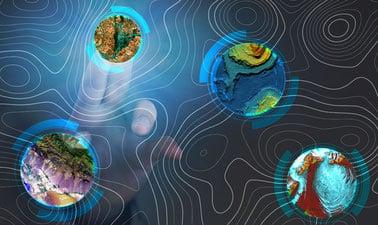
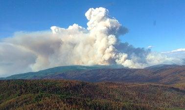
Welcome to Remote Sensing Image Acquisition, Analysis and Applications, in which we explore the nature of imaging the earth's surface from space or from airborne vehicles. This course covers the fundamental nature of remote sensing and the platforms and sensor types used. It also provides an in-depth treatment [...]

Drones for Agriculture: Prepare and Design Your Drone (UAV) Mission (edX)

Take a dive and expand your knowledge about drones en drone technology. Learn how to prepare and execute a flight mission with an Unmanned Aerial Vehicle (UAV) and how to use, process and understand the collected drone data for your own applications.

Remote Sensing of Wildfires (edX)

Learn how satellite imagery and the science of remote sensing allows us to detect wildfires, help manage their spread, and guide ecological restoration. Wildfires are a natural and essential part of our ecosystem, recycling soil nutrients and renewing healthy forests. In Alaska, around one million acres (4000 km2) burn [...]

GIS Image Analysis in ArcGIS Pro (edX)

Learn fundamentals of remote sensing, image analysis, image processing and its application on real-world problems such as vegetation health, wildfire severity, and flooding. Image analysis is extraction of meaningful information from an image to accomplish a simple task like understanding the landscape or to solve a complex problem like [...]

Synthetic Aperture Radar: Foundations (edX)

This course provides foundational knowledge of Synthetic Aperture Radar (SAR) remote sensing including SAR imaging, SAR interferometry, and the concepts of polarimetric SAR. The individual concepts will be illustrated with data sets from spaceborne and airborne SAR missions.

New Space Economy (edX)

The New Space Economy is a fast-growing market, driven by the commercialization of the historical institutional space sector. This course contains more than 30 videos-lectures from space experts from various fields.

Introduction to Urban Geo-Informatics (edX)

Learning about geospatial technologies, such as GIS, Remote Sensing, GNSS and Underground Mapping, to solve urban environmental issues. In this course, you will explore various technologies involved in Geo-Informatics, how the technologies help us to retrieve spatial data, and more importantly how the geographical data becomes the information used [...]