This course will introduce the contributions of Synthetic Aperture Radar (SAR) remote sensing to the monitoring of Earth’s ecosystems. Learn how the weather-independence of SAR combined with its ability to penetrate into vegetation canopies make SAR an excellent information source to characterize vegetation structure, measure above-ground biomass, and analyze the change of vegetation long term and throughout the seasons.
Class Deals by MOOC List - Click here and see EdX's Active Discounts, Deals, and Promo Codes.
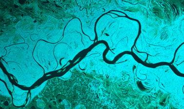
Remote sensing observations have become an essential tool in observing the state and evolution of the earth’s ecosystems. They are a unique means to gain an immediate and regional- to continental-scale view of the earth environment, allowing for the monitoring of entire biomes and their changes with time.
This course will introduce you to Synthetic Aperture Radar (SAR), a remote sensing technology that can see the ground even during darkness and through rain, clouds, or smoke. As a participant in this course, you will learn how the weather-independence of SAR combined with its ability to penetrate into vegetation canopies make SAR an excellent information source to characterize vegetation structure, measure above-ground biomass, and analyze the change of vegetation long term and throughout the seasons. Each SAR ecosystem application will be illustrated with relevant data sets and hands-on exercises. Specific topics include:
- The concepts and principles of SAR and polarimetric SAR
- How to access and visualize SAR data
- Interpretation of SAR images at different wavelengths and polarizations in the context of ecosystems monitoring
- The use of SAR in monitoring forest degradation
- Techniques for estimating forest biomass from SAR
- The application of SAR to the monitoring of agriculture extent
The learned concepts will be put into action in using SAR time series data sets from spaceborne SAR missions over agriculture sites and forested regions undergoing degradation. Learners registered for the verified track will additionally get the opportunity for hands-on lab exercises using Jupyter Notebooks. The verified track will also include peer discussions and a verified certificate upon successful completion.
This course is part of the Synthetic Aperture Radar (SAR): Applications Professional Certificate.
Prerequisites:
- General proficiency in GIS
- For verified track: Basic knowledge in Python programming
- ARSET Level-0 Training “Fundamentals of Remote Sensing” or equivalent
- ARSET Level-1 Training “Introduction to Synthetic Aperture Radar” or equivalent
What you'll learn
Participants in this course will develop the following skills:
- Intuitive understanding of SAR images and polarimetric SAR
- Understanding the role of wavelength and signal polarization when applying SAR to the monitoring of ecosystems
- Use SAR data to map and monitor agriculture extent
- Apply SAR to map and assess forest degradation activities
- Techniques to measure above-ground forest biomass from spaceborne SAR observations.
Syllabus
Week 1: Contribution of SAR to Monitoring forests
Week 2: SAR for Agriculture Monitoring
Week 3: Forest Degradation / Deforestation using SAR remote sensing
Week 4: Biomass estimation using SAR