Introduction to Geospatial Technology Using QGIS (Canvas.net)

Offered by Del Mar College,
Introduction to Geospatial Technology Using QGIS (Canvas.net)

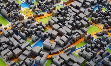
This course provides a rich introduction to the booming technology field of Geographic Information Systems, known as GIS. The GIS industry is exploding at double-digit employment and income numbers and promises employment opportunities well into the future. Students will learn the fundamentals of GIS and how to build digital maps using open source software that allows free unlimited use for private or commercial applications. All data and software required is included in the course.

Topics covered in this course include GIS, cartography, remote sensing, and spatial analysis through a series of lectures and hands-on computer-based exercises. This course is designed to be used as a stand-alone course to complement other disciplines or as an entry level course into a geospatial program. Course content is based upon the United States Department of Labor’s Geospatial Technology Competency Model for entry level geospatial occupations, including Geospatial or GIS Technicians and Technologists.
Learning Outcomes/Competencies

  • Describe the fundamental concepts of Geographic Information Science and Technology.
  • Demonstrate proficiency in the basic functions of geospatial software.
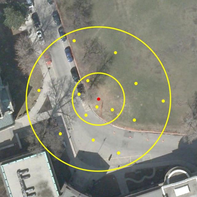
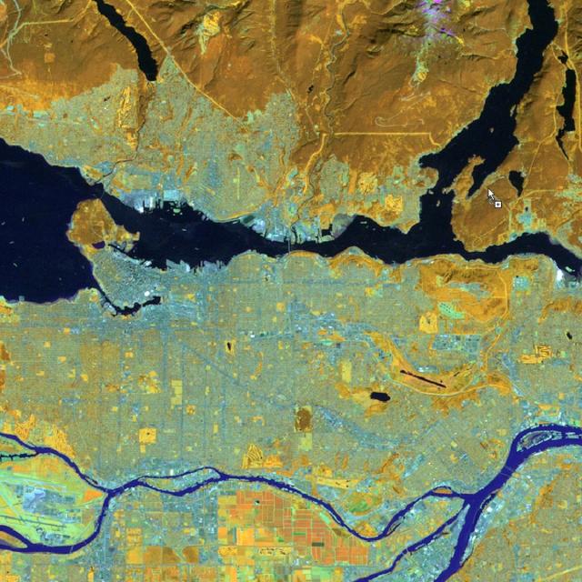
  • Demonstrate awareness of fundamental remote sensing and spatial analysis techniques.
  • Demonstrate basic proficiency in map creation and design principles, including thematic map display, employment of map projections, and cartographic design.
  • Demonstrate proficiency in the creation and acquisition of spatial data.
Go to Class
MOOC List is learner-supported. When you buy through links on our site, we may earn an affiliate commission.

Related Courses

Geohealth: Improving Public Health through Geographic Information (FutureLearn) FutureLearn
University of Twente

Geohealth: Improving Public Health through Geographic Information (FutureLearn)

Explore how spatial data and geographic information systems (GIS) can be used to understand and improve public health. The environment in which we live and work can have a profound effect on our health – an effect that is explored by the emerging field of geohealth. This free online course will introduce you to new developments in geohealth, looking at the latest thinking and methods for using spatial data and geographic information systems (GIS) in health settings.

No sessions available
4 Weeks
Geospatial Analysis with ArcGIS (Coursera) Coursera
University of California, Davis

Geospatial Analysis with ArcGIS (Coursera)

Apply your GIS knowledge in this course on geospatial analysis, focusing on analysis tools, 3D data, working with rasters, projections, and environment variables. Through all four weeks of this course, we'll work through a project together - something unique to this course - from project conception, through data retrieval, initial data management and processing, and finally to our analysis products.

May 25th 2026
4 Weeks
Explorer l’espace des humains: une introduction à la géographicité (edX) EdX
École Polytechnique Fédérale de Lausanne,EPFLx

Explorer l’espace des humains: une introduction à la géographicité (edX)

Explorer comment la géographie, la cartographie, l’urbanisation et la justice spatiale jouent un rôle dans la compréhension de l’espace des humains et des sociétés. Comment définir et comprendre la notion d’espace? Comment l’urbanisation, la mobilité, Internet et la mondialisation ont-ils influencé notre perception du temps et de l’espace? Ce cours a pour objectif de définir la notion d’espace en apportant des clés de lecture pour comprendre les sociétés qui nous entourent.

Self Paced
Self-Paced
Fundamentals of GIS (Coursera) Coursera
University of California, Davis

Fundamentals of GIS (Coursera)

Explore the world of spatial analysis and cartography with geographic information systems (GIS). What you will learn: define core geospatial concepts; practice with subset data using selections and feature attributes; create map books using advanced mapping techniques; create layer and map packages.

Jun 1st 2026
4 Weeks
Do-It-Yourself Geo Apps (Esri) Esri
Esri

Do-It-Yourself Geo Apps (Esri)

You don’t have to be a software developer to build valuable geo-enabled apps that make your communities smarter and businesses more successful. This course will show you how to combine location and narrative in one application to better communicate and broadcast your story, create custom web applications that solve problems in your community, and build powerful native applications for iOS and Android devices without touching a piece of code.

Jan 26th 2022
4 Weeks
Cartography (Esri) Esri
Esri

Cartography (Esri)

Once, only cartographers made maps. Today anyone can. Still, cartographers can teach people to make better maps, just as chefs can show people how to cook better meals. With coaching from experienced cartographers and practical, hands-on exercises using ArcGIS Pro, you'll become a smarter mapmaker, ready to go beyond the defaults and make better maps.

Feb 16th 2022
5-12 Weeks
Adventures in Innovative Learning Design and Technology (Canvas.net) Canvas Network
New Mexico State University

Adventures in Innovative Learning Design and Technology (Canvas.net)

Participants will engage in a fun four-week adventure to develop a practical and experiential understanding of pedagogy, learning theory, and learning design with technology. Educators and educators-in-training in higher education, as well as teachers and educational specialists in primary and secondary schools, will find value in this course.

Sep 8th 2014
4 Weeks
Modellazione digitale 3D: input (POK) Polimi OPEN KNOWLEDGE
Politecnico di Milano

Modellazione digitale 3D: input (POK)

Importare, georeferenziare e gestire, in ambiente CAD, database cartografici e fotogrammetrici. Il programma, di carattere prettamente operativo, si propone di fornire indicazioni pratiche per l’acquisizione e la gestione di cartografia da geoportale, per l’acquisizione e la gestione di dati metrico spaziali acquisiti tramite scansione 3D in ambiente reale, e per la georeferenziazione e integrazione delle informazioni in ambiente CAD.

Available
2 Weeks
Imagery, Automation, and Applications (Coursera) Coursera
University of California, Davis

Imagery, Automation, and Applications (Coursera)

Welcome to the last course of the specialization (unless your continuing on to the capstone project, of course!). Using the knowledge you’ve learned about ArcGIS, complete technical tasks such raster calculations and suitability analysis. What you will learn:Use the imagery in two different common types of analysis: NDVI and trained classification; Practice with tools to support image analysis using Raster Calculation and Spatial Analyst; Develop a large processing workflow in ModelBuilder; Use products derived from digital elevation models

Jun 17th 2024
4 Weeks