Imagery, Automation, and Applications (Coursera)

Imagery, Automation, and Applications (Coursera)

Welcome to the last course of the specialization (unless your continuing on to the capstone project, of course!). Using the knowledge you’ve learned about ArcGIS, complete technical tasks such raster calculations and suitability analysis. What you will learn:Use the imagery in two different common types of analysis: NDVI and trained classification; Practice with tools to support image analysis using Raster Calculation and Spatial Analyst; Develop a large processing workflow in ModelBuilder; Use products derived from digital elevation models

Class Deals by MOOC List - Click here and see Coursera's Active Discounts, Deals, and Promo Codes.

In this class you will become comfortable with spatial analysis and applications within GIS during four week-long modules:
Week 1: You'll learn all about remotely sensed and satellite imagery, and be introduced to the electromagnetic spectrum. At the end of this week, you'll be able to find and download satellite imagery online and use it for two common types of analysis: NDVI and trained classification.
Week 2: You'll learn how to use ModelBuilder to create large processing workflows that use parameters, preconditions, variables, and a new set of tools. We'll also explore a few topics that we don't really have time to discuss in detail, but might whet your appetite for future learning in other avenues: geocoding, time-enabled data, spatial statistics, and ArcGIS Pro.
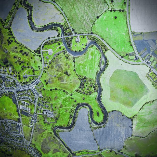
Week 3: In week three, we'll make and use digital elevation models using some new, specific tools such as the cut fill tool, hillshades, viewsheds and more. We'll also go through a few common algorithms including a very important one: the suitability analysis.
Week 4: We'll begin the final week by talking about a few spatial analyst tools we haven't yet touched on in the specialization: Region Group to make our own zones, Focal Statistics to smooth a hillshade, Reclassify to change values, and Point Density to create a density surface. Finally, we'll wrap up by talking about a few more things that you might want to explore more as you start working on learning about GIS topics on your own.
Take Geospatial and Environmental Analysis as a standalone course or as part of the Geographic Information Systems (GIS) Specialization. You should have equivalent experience to completing the first, second, and third courses in this specialization, "Fundamentals of GIS," "GIS Data Formats, Design, and Quality", and "Geospatial and Environmental Analysis," respectively, before taking this course. By completing the fourth class you will gain the skills needed to succeed in the Specialization capstone.
Course 4 of 5 in the Geographic Information Systems (GIS) Specialization.

Syllabus

WEEK 1
Course Overview, Imagery, and Raster Calculator
In this module, we'll learn all about remote sensing and satellite imagery, starting out with an introduction to remotely sensed data and the electromagnetic spectrum before learning about satellite and aerial imagery capture and data products. You'll learn how to find and download satellite imagery online and how to use it in two different common types of analysis: NDVI and a trained classification. In the second lesson, you'll learn how to use some basic tools to support image analysis using Raster Calculator and Spatial Analyst.

WEEK 2
ModelBuilder and Other Topics
In this module, we will learn about ModelBuilder, a drag and drop tool for automating, and reusing workflows in ArcGIS. We'll explore how models are constructed, build our own models, and undertake building a large processing workflow together in ModelBuilder that uses parameters, preconditions, variables, and a set of tools we haven't used before to work. In the second half of the module, we'll take a brief look at a few topics you should know about, but that we won't have time to explore in depth. You'll be introduced to geocoding, time enabled data, spatial statistics, and ArcGIS Pro. These are little teasers of potential capabilities you might want to explore more in the future on your own.

WEEK 3
Digital Elevation Models and Common Algorithms
In this module, we'll be looking at DEMs and workflows. In the first half, we'll make and use a handful of products derived from digital elevation models, including contour lines, hillshades, viewsheds, and the cut fill tool. In the second half of the module, we'll go through a few common algorithms, starting with one of the most important ones to know: the suitability analysis. Then, we'll learn about the hydrologic processing you did in the tutorial assignment for the previous module and go through it step by step together.

WEEK 4
Spatial Analyst and Where to Go from Here
In this module, we'll start by learning how to use a few different tools and concepts in Spatial Analyst that we haven't touched on before. We'll use Region Group to make our own zones, Focal Statistics to smooth a hillshade, Reclassify to change values, and Point Density to create a density surface. In the second half of the module, we'll give you some suggestions of directions for future learning by showing you all the things we didn't cover in this specialization, including web and mobile GIS applications, field data collection workflows, industry specific tools and workflows, spatial statistics, in-depth design and cartography, programming and GIS servers, and other GIS systems like QGIS and companion applications like Geospatial Modelling Environment. These can serve as seeds for your future GIS learning and careers!

Go to Class
MOOC List is learner-supported. When you buy through links on our site, we may earn an affiliate commission.

Related Courses

Algorithmic Toolbox (Coursera) Coursera
University of California, San Diego,Higher School of Economics - HSE University

Algorithmic Toolbox (Coursera)

The course covers basic algorithmic techniques and ideas for computational problems arising frequently in practical applications: sorting and searching, divide and conquer, greedy algorithms, dynamic programming. We will learn a lot of theory: how to sort data and how it helps for searching; how to break a large problem into pieces and solve them recursively; when it makes sense to proceed greedily; how dynamic programming is used in genomic studies. You will practice solving computational problems, designing new algorithms, and implementing solutions efficiently (so that they run in less than a second).

Jun 15th 2026
5-12 Weeks
Information Theory (Coursera) Coursera
The Chinese University of Hong Kong

Information Theory (Coursera)

At the completion of this course, the student should be able to: demonstrate knowledge and understanding of the fundamentals of information theory; appreciate the notion of fundamental limits in communication systems and more generally all systems; develop deeper understanding of communication systems; apply the concepts of information theory to various disciplines in information science.

Jun 15th 2026
13-24 Weeks
Unordered Data Structures (Coursera) Coursera
University of Illinois at Urbana-Champaign

Unordered Data Structures (Coursera)

The Unordered Data Structures course covers the data structures and algorithms needed to implement hash tables, disjoint sets and graphs. These fundamental data structures are useful for unordered data. For example, a hash table provides immediate access to data indexed by an arbitrary key value, that could be a number (such as a memory address for cached memory), a URL (such as for a web cache) or a dictionary.

Jun 17th 2026
4 Weeks
Shortest Paths Revisited, NP-Complete Problems and What To Do About Them (Coursera) Coursera
Stanford University

Shortest Paths Revisited, NP-Complete Problems and What To Do About Them (Coursera)

The primary topics in this part of the specialization are: shortest paths (Bellman-Ford, Floyd-Warshall, Johnson), NP-completeness and what it means for the algorithm designer, and strategies for coping with computationally intractable problems (analysis of heuristics, local search).

Jun 15th 2026
4 Weeks
Object Oriented Programming in Java (Coursera) Coursera
University of California, San Diego

Object Oriented Programming in Java (Coursera)

Welcome to our course on Object Oriented Programming in Java using data visualization. People come to this course with many different goals -- and we are really excited to work with all of you! Some of you want to be professional software developers, others want to improve your programming skills to implement that cool personal project that you’ve been thinking about, while others of you might not yet know why you’re here and are trying to figure out what this course is all about.

Jun 15th 2026
5-12 Weeks
计算导论与C语言基础 (Coursera) Coursera
Peking University

计算导论与C语言基础 (Coursera)

你有没有好奇过:计算机为什么能够进行计算?计算机程序是怎样运行的?你是否想知道:计算机未来可能的发展趋势有哪些?程序是如何编写出来的?如何学习程序设计语言?程序设计语言的基本成分有哪些?《计算导论》这门课将帮助你解决这些疑惑。

Jun 15th 2026
5-12 Weeks
Data Structures and Performance (Coursera) Coursera
University of California, San Diego

Data Structures and Performance (Coursera)

How do Java programs deal with vast quantities of data? Many of the data structures and algorithms that work with introductory toy examples break when applications process real, large data sets. Efficiency is critical, but how do we achieve it, and how do we even measure it? This is an intermediate Java course. We recommend this course to learners who have previous experience in software development or a background in computer science, and in particular, we recommend that you have taken the first course in this specialization (which also requires some previous experience with Java).

Jun 15th 2026
5-12 Weeks
Practical Machine Learning (Coursera) Coursera
Johns Hopkins University

Practical Machine Learning (Coursera)

One of the most common tasks performed by data scientists and data analysts are prediction and machine learning. This course will cover the basic components of building and applying prediction functions with an emphasis on practical applications. The course will provide basic grounding in concepts such as training and tests sets, overfitting, and error rates.

Jun 15th 2026
4 Weeks
Ecosystem Services: a Method for Sustainable Development (Coursera) Coursera
University of Geneva

Ecosystem Services: a Method for Sustainable Development (Coursera)

Ecosystem services are a way of thinking about – and evaluating – the goods and services provided by nature that contribute to the well-being of humans. This MOOC will cover scientific (technical), economic, and socio-political dimensions of the concept through a mix of theory, case-studies, interviews with specialists and a serious-game.

Jun 15th 2026
5-12 Weeks
Fundamentals of GIS (Coursera) Coursera
University of California, Davis

Fundamentals of GIS (Coursera)

Explore the world of spatial analysis and cartography with geographic information systems (GIS). What you will learn: define core geospatial concepts; practice with subset data using selections and feature attributes; create map books using advanced mapping techniques; create layer and map packages.

Jun 15th 2026
4 Weeks
算法基础 (Coursera) Coursera
Peking University

算法基础 (Coursera)

本课程内容程涵盖枚举、二分、贪心、递归、深度优先搜索、广度优先搜索、动态规划等基本算法。通过大量的高强度的编程训练,提高动手能力,做到能较为熟练、完整、准确地实现自己设计的程序,为进一步学习其他计算机专业课程,或在其他专业领域运用计算机编程解决问题奠定良好的基础。

Jun 15th 2026
5-12 Weeks